Our Highlight Video

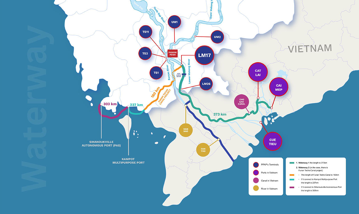
Navigation Map
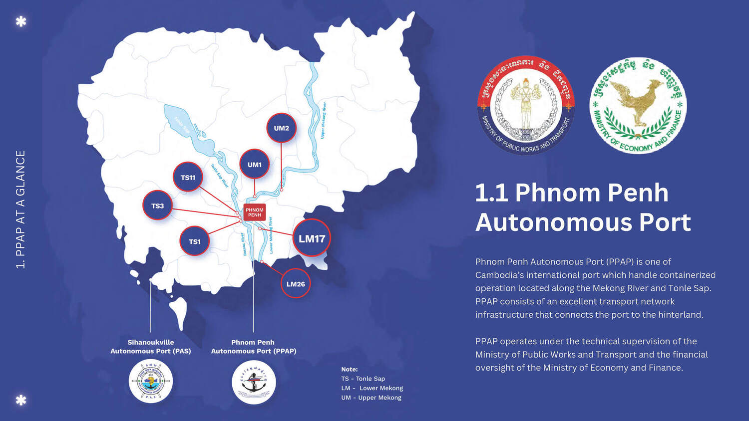
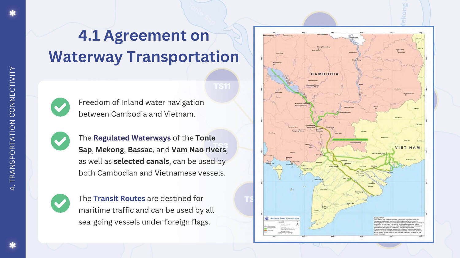
From PPAP To International Sea
PPAP uses Mekong river as a primary navigation route, connecting all of its terminals to ports in Vietnam for transshipment of container cargo, break bulk cargo, and general cargo. Additionally, it also supports passenger cruise operations along the river. The access distance to PPAP’s port (LM26) is about 300-375 km from the Cuu Tieu entrance mouth, part of South China Sea, and about 100km from Kaam Samnar, Cambodia-Vietnam border gate. The access channels to the port taken by the Bassac/Hau Giang and Mekong/Tien Giang River.
Trucking Road Map
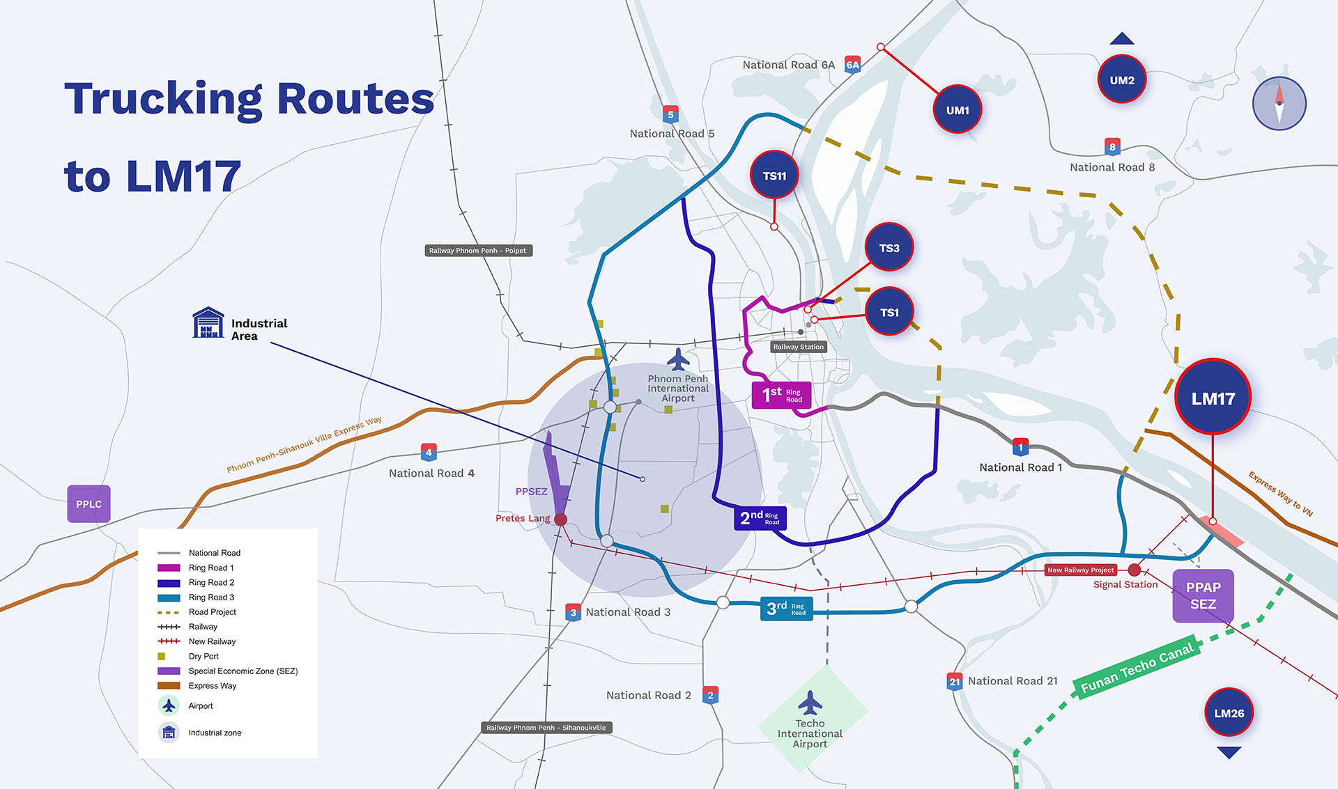
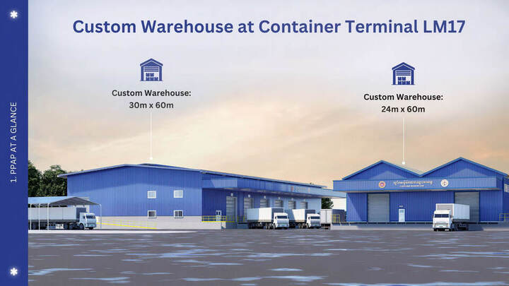
From Phnom Penh City To Container Terminal LM17
PPPAP offers flexible transportation solutions for moving cargo from the city to the Container Terminal LM17, located approximately 30 kilometers away. This service ensures seamless logistics operations and timely delivery of goods. Tracking Options:
To monitor the progress of your road shipment, PPAP provides three convenient tracking methods:
- From Vensreng (Phnom Penh industrial area) via National Road 1:
- Travel along the road to Monivong Bridge.
- Proceed directly to National Road 1.
- Continue straight on National Road 1 until you reach LM17.
- Ring Road 2:
- Take Ring Road 2 to National Road 1.
- Proceed directly to LM17.
- Ring Road 3:
- Travel directly on Ring Road 3 to LM17.
By utilizing these efficient routes and advanced tracking systems, PPAP guarantees reliable and timely cargo delivery to the LM17 Container Terminal.
 Road map from city to Container Terminal LM17
 Road map from city to Container Terminal LM17
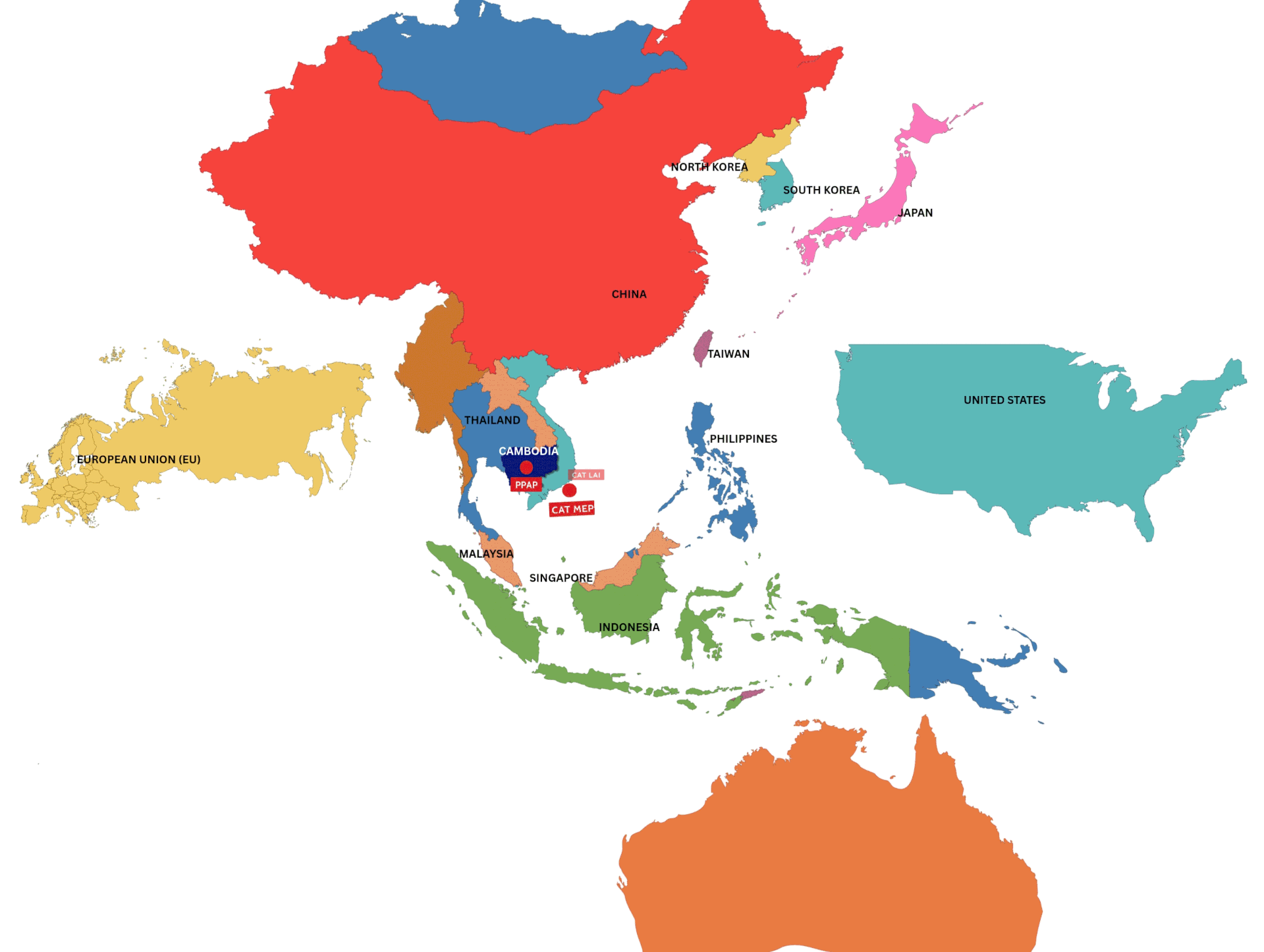
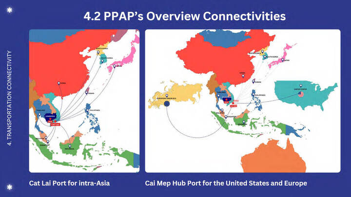
Global Connectivity
Linked PPAP To The World
PPAP has established a robust global connectivity that spans multiple continents, with a particularly strong presence in Asian and European countries, as well as in the United States. Within Vietnam, Cat Lai and Cai Mep hub ports serve as the primary hubs for the transit of goods, facilitating the movement of cargo to various international destinations. Cat Lai port is primarily for intra-Asia connectivity including Japan, South Korea, China, Singapore, Indonesia, and Malaysia while Cai Mep hub port is for connections to Europe and the United states.
Moreover, Cai Mep hub port, in particular, plays a crucial role in handling a significant volume of cargo that traverses the continent, acting as a vital gateway for international trade. Its strategic location and advanced facilities enable efficient logistical operations, ensuring that shipments are processed swiftly and promptly. This extensive network not only enhances PPAP's operational capabilities but also reinforces its commitment to providing seamless and efficient service to its global clientele. By leveraging these key ports, PPAP is well-positioned to meet the diverse needs of its customers and expand its reach in the global market.
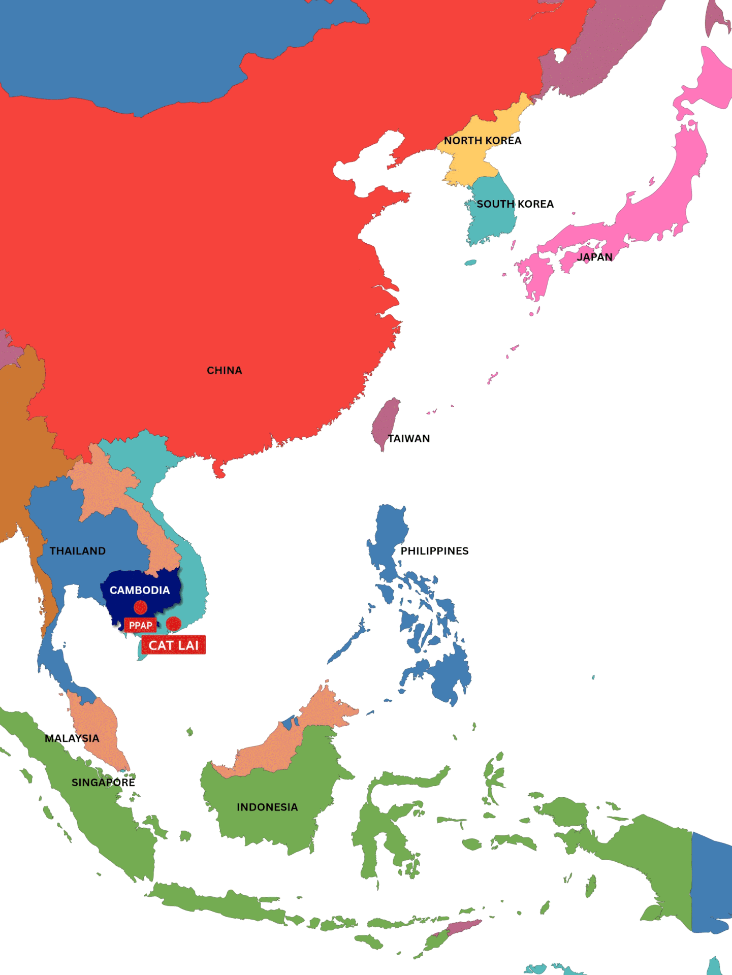
Navigation Route From PPAP to Cat Lai